March, 2026
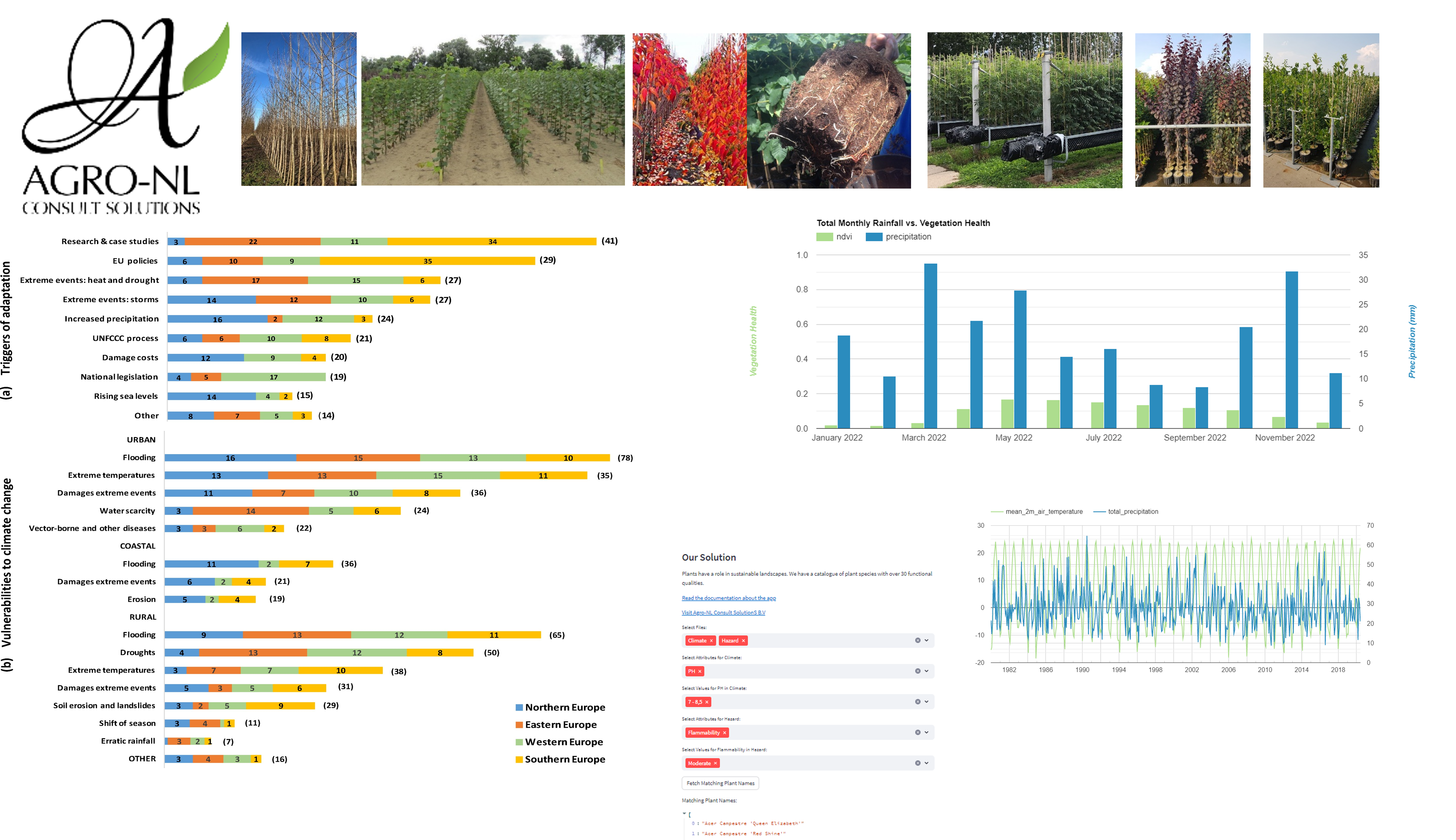
This research explores the interactions between climate change and land-use dynamics and how these processes can enhance conservation and biodiversity management practices across conservation landscapes in West Africa. The project focuses on understanding climate products and risks, land-use change patterns, and ecosystem responses to support sustainable landscape planning and conservation management strategies.
A collaborative team and experts and regional stakeholders will work together to develop science-based approaches for climate-resilient land management, habitat protection, and biodiversity restoration.
The project also integrates geospatial analysis, climate data, and policy assessment to support evidence-based decision-making for long-term ecosystem resilience and sustainable development across conservation priority areas.
An IPCC Special Report is an assessment by the Intergovernmental Panel on Climate Change (IPCC) focusing on specific climate change topics,
specific climate change topics, often requested by governments or organizations to address urgent issues. Unlike comprehensive assessment reports, these provide targeted, in-depth
scientific analysis,
of niche areas such as ocean health, land degradation, or specific warming targets to guide policy actions, sustainable development, and adaptation strategies.
We provided indepth review of these report chapters to authors and editors of the IPCC Special Reports.
Mentor/Referee: [....]

DesirMED aims to enhance climate resilience in the Mediterranean, a region highly vulnerable to climate change. By prioritizing Nature-Based Solutions and fostering regional collaboration, DesirMED empowers communities and leaders across multiple Mediterranean regions to implement transformative adaptation strategies. This project aligns with the European Climate Adaptation Mission's goal to make at least 150 regions climate-resilient by 2030, a diverse team including researchers from the
CMCC, officials from the
Technalia,
and important local stakeholders from multiple sectors within the European Union will collaborate to create adaptation pathways for multi-hazard, multi-system resilience, with European data standards.
In addition, collaborate on the REST-COAST and NBRACER projects to support the mainstreaming of Nature-Based Solutions (NBS) for long-term climate resilience across key landscapes.
Mentor/Referee: [Prof. Mindert de Vries]
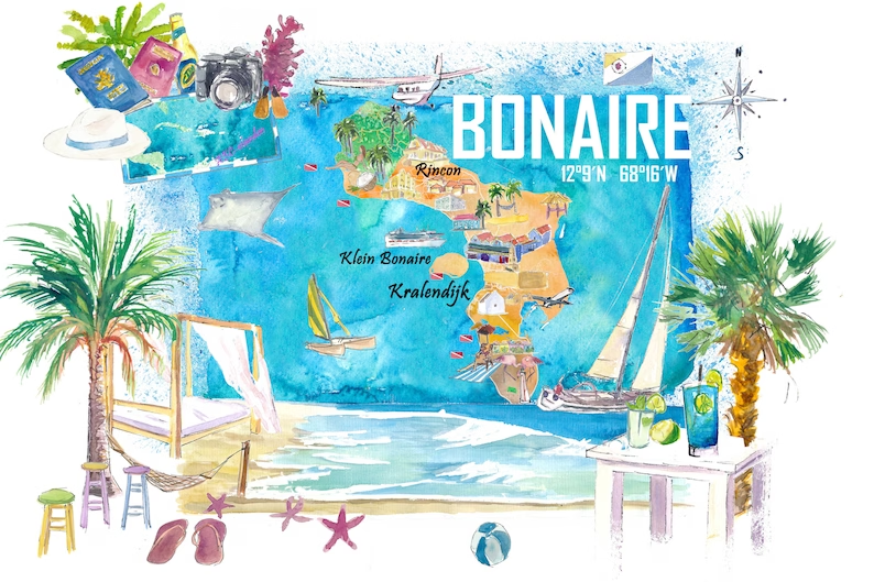
Physical activity rates differ across the world, with evidence pointing to particularly low levels within Caribbean communities.
The Caribbean Dutch municipality of Bonaire exemplifies this trend.
To address this issue, a diverse team including researchers from the
Urban Cycling Institute, officials from the
Ministry of Health, Welfare and Sports,
and important local stakeholders from multiple sectors in Bonaire will collaborate to boost physical activity and promote health equality on the island.
We provided spatial planning analysis support to conduct accessibility analysis of environmental determinants for Bonaire. Moreso, we used policy documents and existing open-source data e.g., Geo Open Accessibility Tool, OpenStreetMap to map the policy contexts, accessibility, land use, parks, trails, playgrounds, transport infrastructure, etc.
Mentor/Referee: [Prof. Meredith Glaser, Dylan Power, PhD]
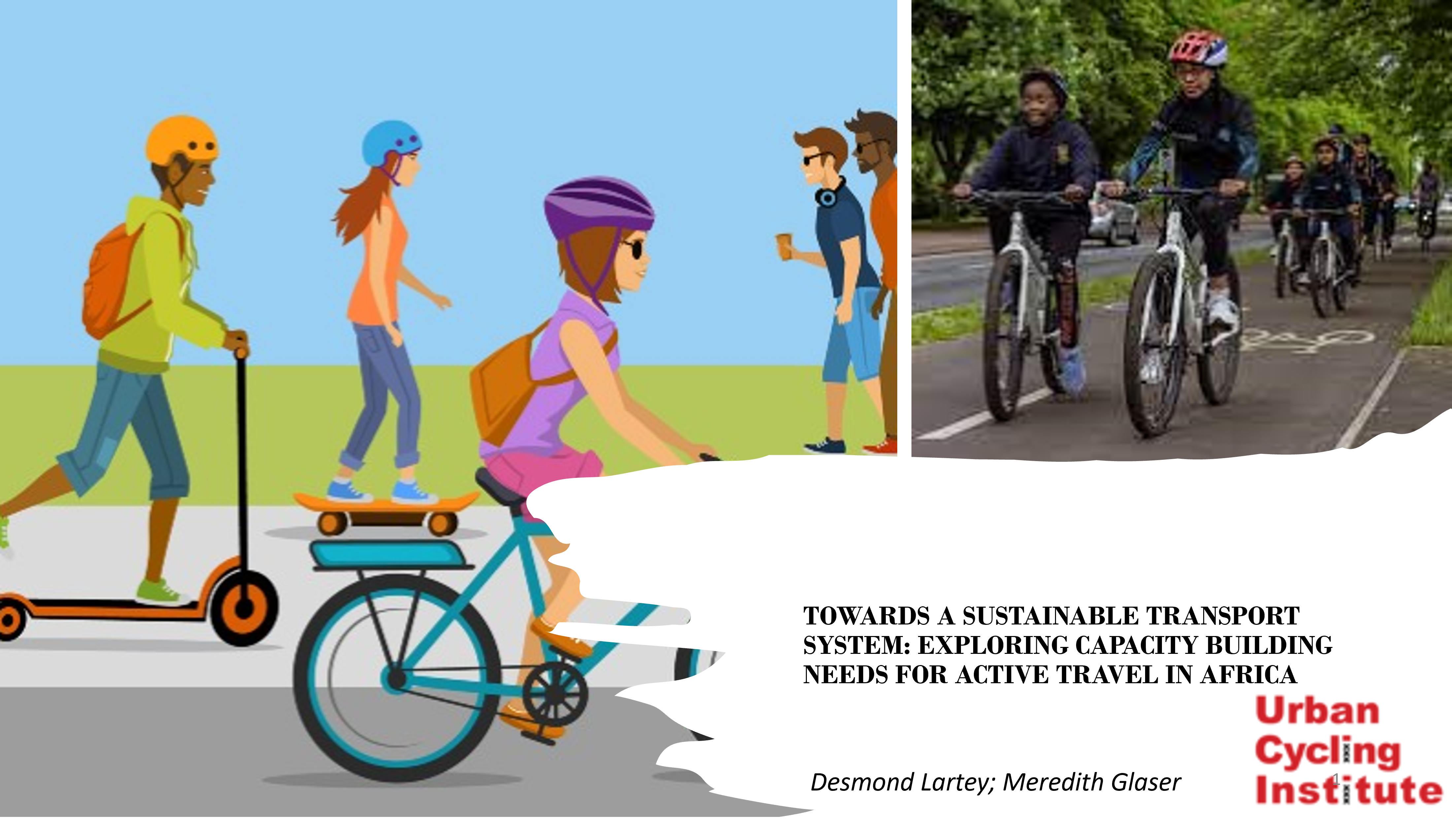
The promotion of sustainable transportation systems and improved public health outcomes depends on the development of active travel capacity. In this project, we dive more into what capacity building for active travel mean and how could these frameworks helps to address Africa's transport system. Part of this is also to explore the role of Participatory GIS in capacity for active travel.
Mentor/Referee: [Prof. Meredith Glaser]
As cities experience rapid growth, the threat of environmental hazards looms large. Our project on Urban green and sustainability provides cities with tangible solutions that not only enhance the aesthetic appeal of urban areas but also contribute positively to the environment as well as mitigate climate change impact. Read more about the project here.
Mentor/Referee: [Alina Lomans]
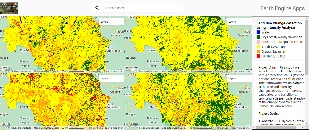
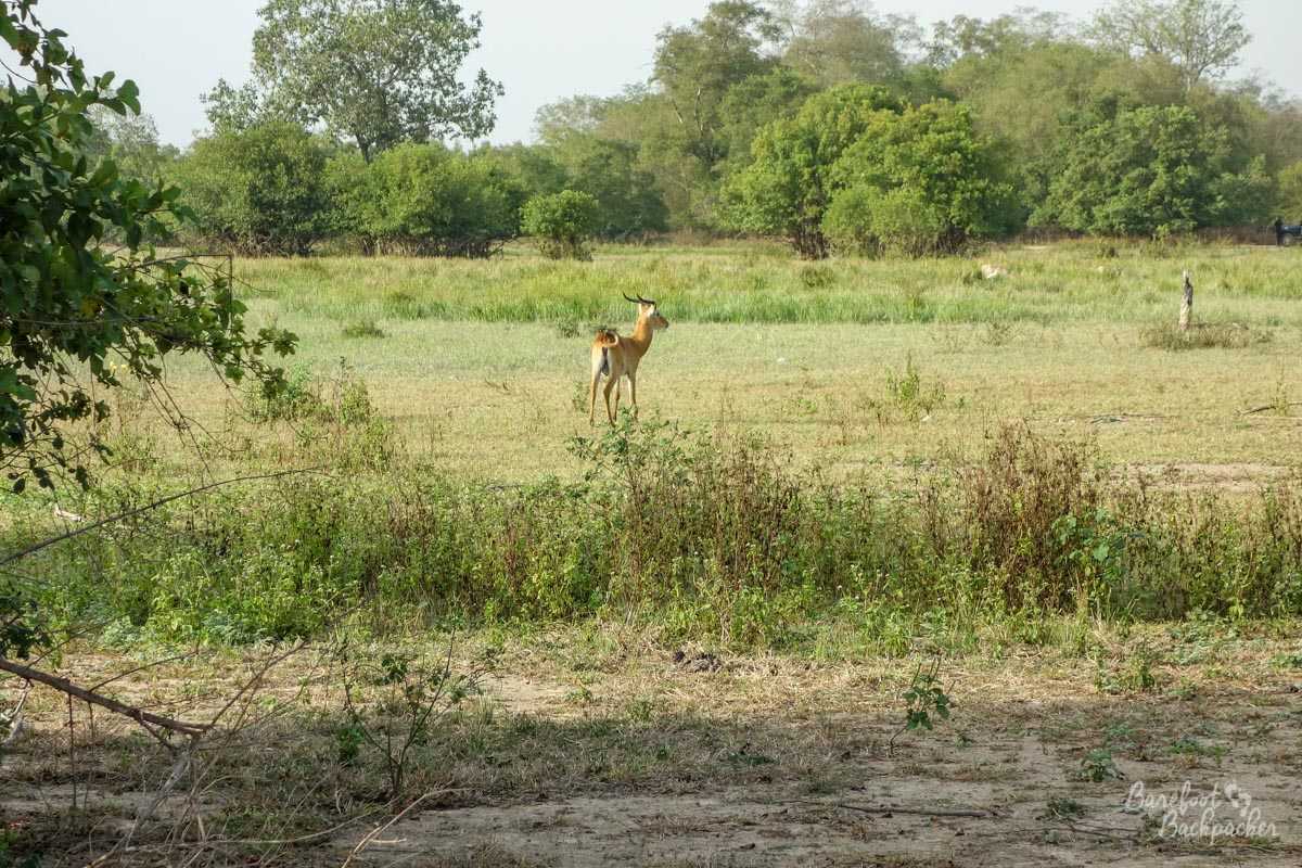
In the face of rapid environmental shifts and anthropogenic pressures, the effective monitoring and management of conservation areas have become paramount. Our Research focuses on National Reserves increasingly vulnerable to threats from urbanization and resource degradation. To address this, our research aimed to produce detailed land use/land cover (LULC) maps and incorporate a robust change detection mechanism tailored for West African conservation reserves. We leverage different Machine Learning Algorithms to create high-quality land use maps and detect changes. Read about the work by following the link bellow.
Mentor/Referee: [Prof. Elmar Veenendaal, dr. NE (Nandika) Tsendbazar]
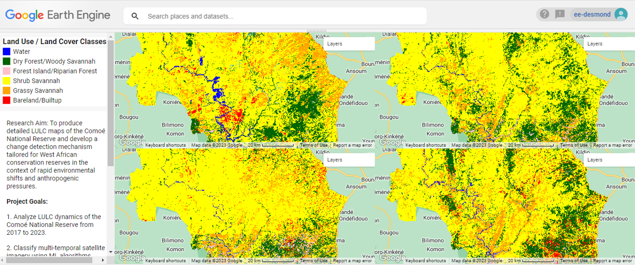
In the face of rapid environmental shifts and anthropogenic pressures, the effective monitoring and management of conservation areas have become paramount. We need to protect these areas from rapid urbanization and resource degradation. To address this, our research aimed to produce detailed land use/land cover (LULC) maps and incorporate a robust change detection mechanism tailored for West African conservation reserves. Three machine learning algorithms – Random Forest, Support Vector Machine, and Minimum Distance (K-Nearest Neighbour) – were employed to classify multi-temporal satellite imagery. Subsequent change detection analyses were conducted using both Google Earth Engine and ArcGIS Pro to elucidate the patterns of transformations.
Mentor/Referee: [Prof. Elmar Veenendaal, dr. NE (Nandika) Tsendbazar]
In Colombia, the Coffee Berry Borer (CBB) is a major problem.
This beetle reduces crop yield and quality by drilling the coffee berries and feeding on the beans
during the beetles immature stages. Coffee farmers have developed CBB control strategies such as the use
of chemical insecticides, the manual collection of infested berries, and the use of entomopathogenic fungi,
but despite these practices, CBB remains a major problem in coffee production. A promising yet understudied approach to
CBB control is conservation biological control (CBC). In this study, we model land uses in these coffee-grown areas and connect
the regulation of pest populations by supporting populations of naturally occurring natural enemies.
Mentor/Referee: [Prof. Dicke Marcel, Prof. Bianchi, Felix, Moreno Ramírez, Natalia]
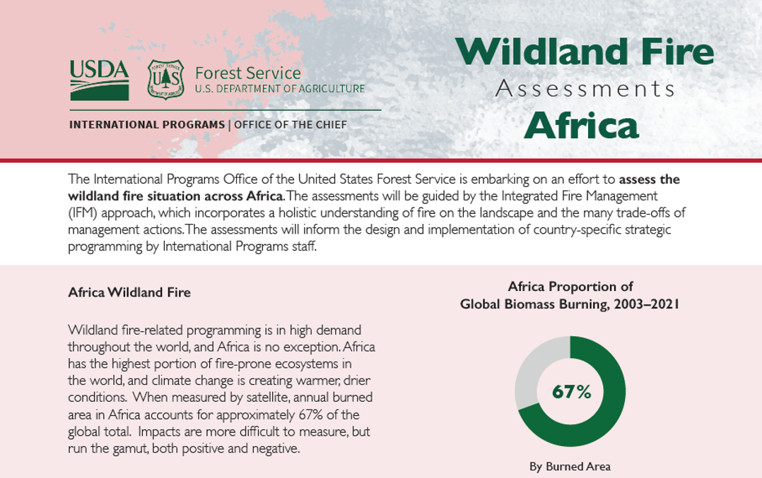
The International Programs Office of the United States Forest Service is embarking on an effort to assess the
wildland fire situation across Africa. The assessments will be guided by the Integrated Fire Management
(IFM) approach, which incorporates a holistic understanding of fire on the landscape and the many trade-offs of
management actions. The assessments will inform the design and implementation of country-specific strategic
programming by International Programs staff.
Mentor/Referee: [Louis Fleming-Forest Service International Programs]
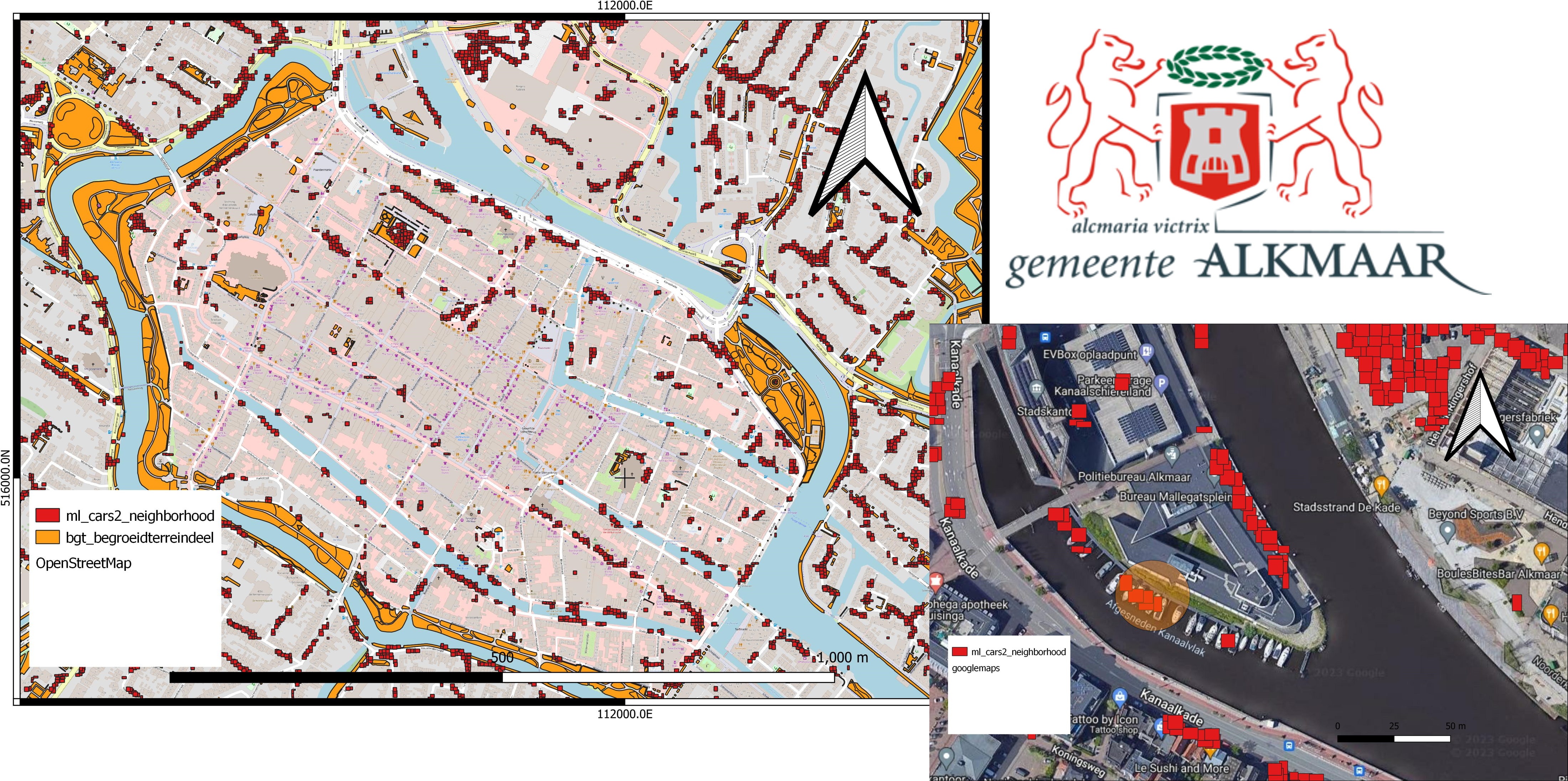
As urbanization continues to increase, managing parking behaviour in municipalities has become an important aspect of urban planning (Litman, 2017). With the rise in the number of vehicles on the roads, finding available parking spaces has become a significant challenge, causing congestion, pollution, and frustration for both drivers and pedestrians (Shoup, 2006). Therefore, understanding parking behaviour is a critical area of study for municipalities to manage and improve parking efficiency. In this project assignment, we are confronted with documenting a geodatabase schema, the processes and how this can be implemented to answer specific information requests on parking for the Municipality of Alkmaar.
Mentor/Referee: [Dr. Maurice de kleijn]
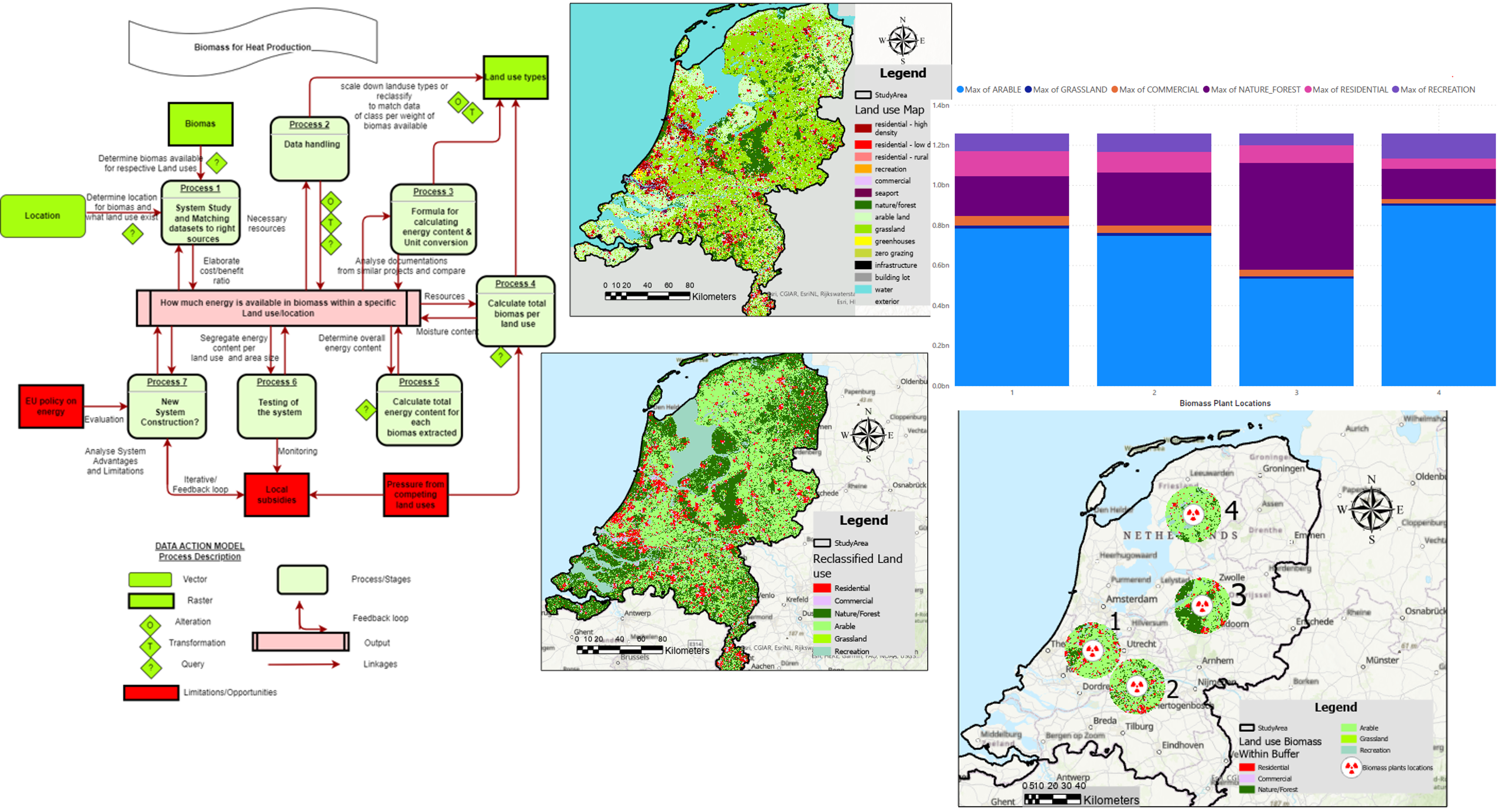
In this project, the challenge is to identify what the best location of biomass production is, the available biomass within a zone of 25km and the energy content within the zone of biomass plants for heat production. This assessment is based on range of factors such as weight of biomass that can be extracted, and available energy content per year per different land use categories.
Mentor/Referee: [ Prof. Ac. Jaar]
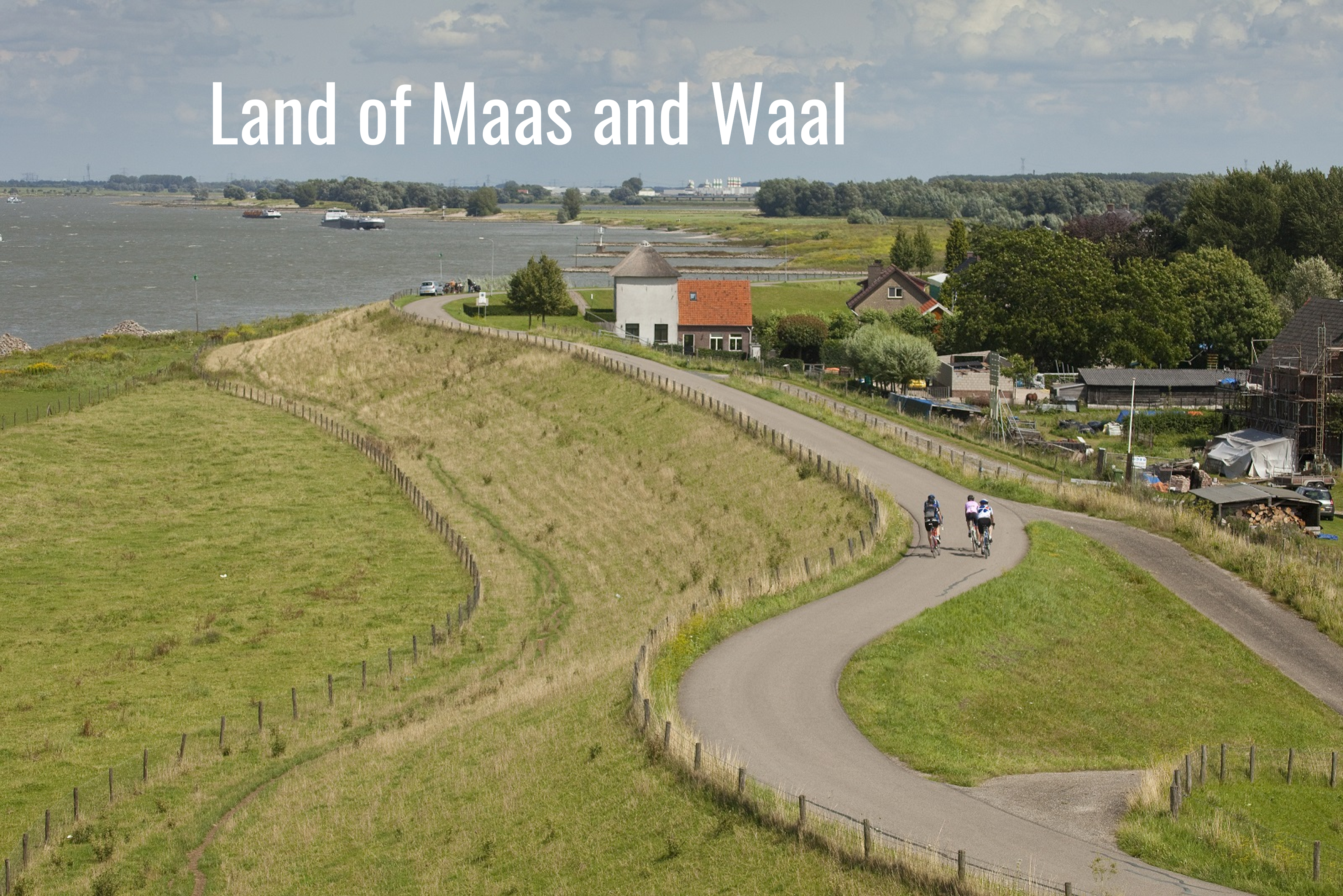
There are multiple challenges that the area is facing. Climate change causes extreme weather events to happen more often. There will be more torrential rains, heavier storms or long dry and hot periods. The Land of Maas and Waal is vulnerable for flooding because it is surrounded by rivers. Especially in the last years, the drought is also troubling. The continue effects of climate and water related issues have consequences on land use. Therefore, We analysed the spatial challenge such as flooding, drought, and agriculture of the area and see which areas and population will be susceptible to flood when no action is taken. The main tasks performed included,
•Toekomstig klimaatbestendig ontwerpen (Land van Maas en Waal in 100 jaar)
• Stakeholder engagement and Process analysis
• Gegevensverzameling en analyse
• Designing climate implementation mechanisms
• Schrijven van rapporten.
Mentor/Referee: [Dr. Barbara Tempels, dr.ir. M (Marlies) Brinkhuijsen]
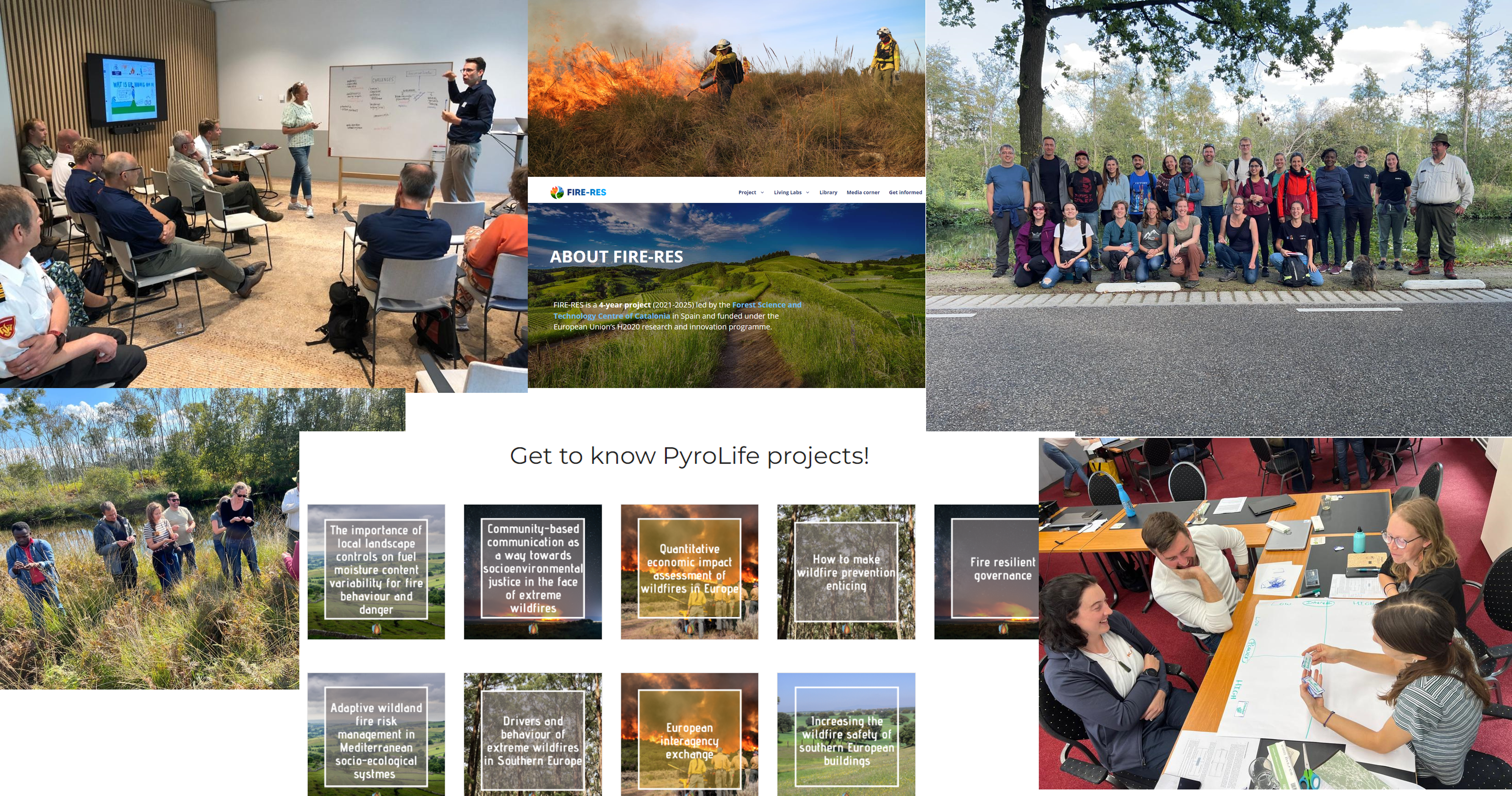
2018 and 2019 were only a glimpse of what to expect in the future: deadly mega-fires in Mediterranean regions, high fire activity in temperate and boreal areas outside typical fire seasons and regions, and politicized deforestation fires in the Amazon. 2019 ended with a fire crisis in Australia that has never been seen before. Striking amidst these fires making year-round headlines is the lack of attention for fires in developing countries. Main tasks in these project is to understand the relationship between Fires, land use and people living in and outside these landscapes. We developed a research agenda to link practinioners and experts for integrated fire management in the Global North and South.
Mentor/Referee: [Dr. Cathelijne Stoof]
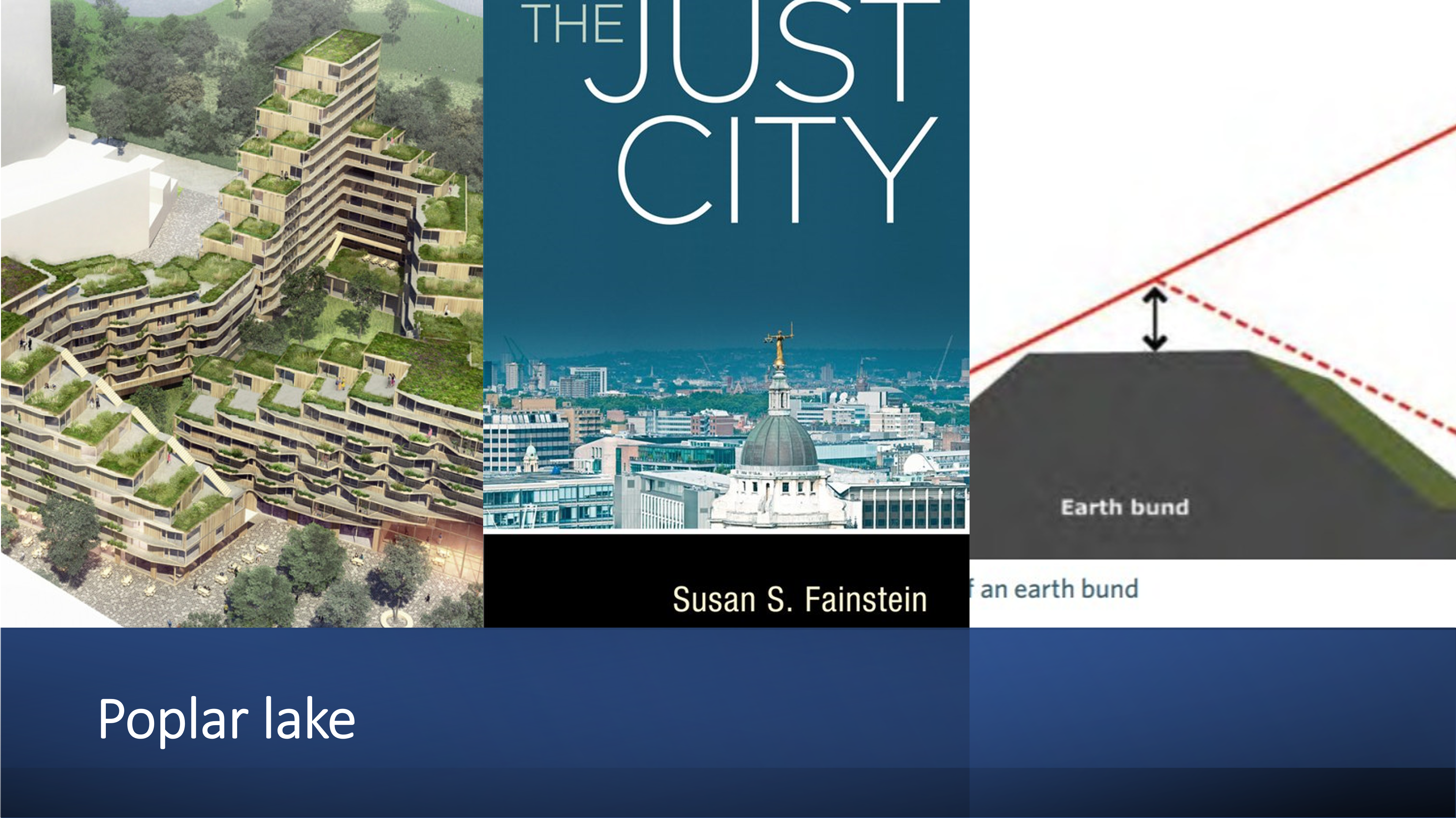
Poplar lake is an active and lively neighborhood. It is structured by three distinct landmarks, lake poplar, Sterflat reloaded and the community center and urban edges which mark the orders of the different districts and the lakeshore (Lynch, 1960)
Mentor/Referee: [Prof. Thomas Hartmann]
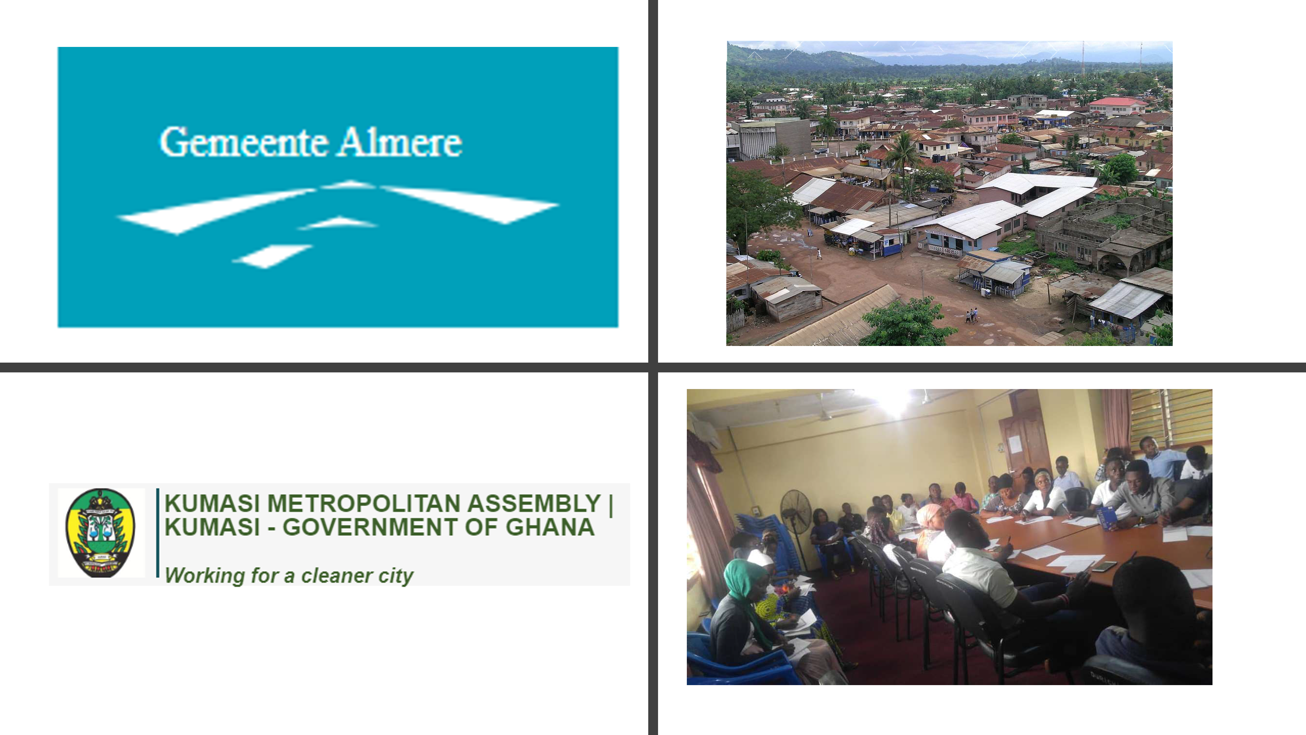
As part of the targeted objectives of the DEALS project, a pre-testing exercise of the data collection
instrument was undertaken as a follow-up to an earlier held training workshop in confidence of
training selected enumerators and supervisors on the goals and objectives of the project. In this
regard, the pre-testing exercise was primarily done with a mission and view to identify the likely
challenges enumerators and respondents (units of enquiry) may face during the main survey period,
conflicting issues such as translation barriers and other worth-noting technical errors in the data
collection instrument for the project
Mentor/Referee: [Dr. Prince Anokye]
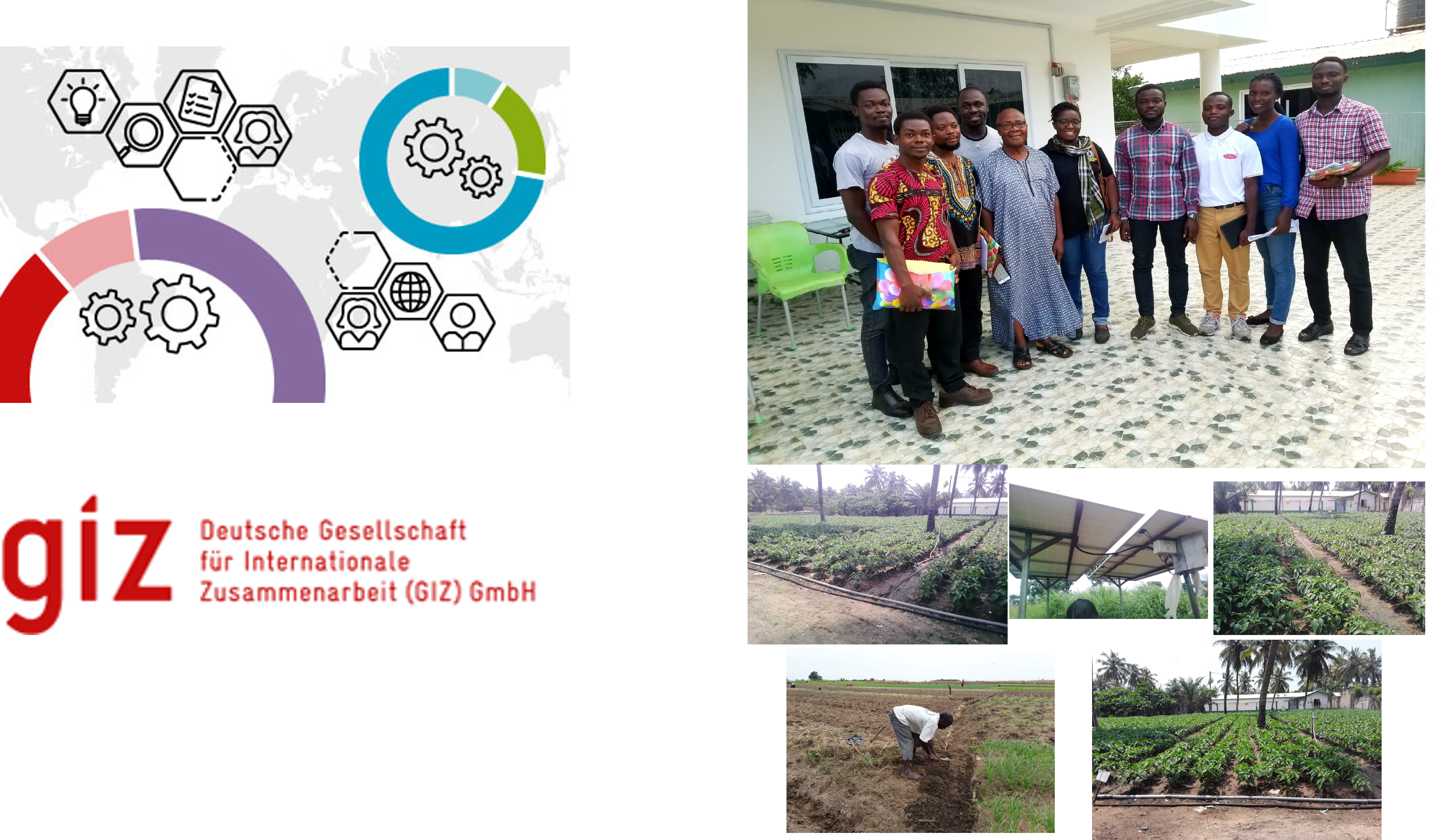
Energizing development is implemented as part of the GIZ Renewable Energy Project in Ghana. EnDev promotes sustainable access to modern energy services that meet the needs of the poor, for a long lasting, affordable, and appreciated by users
Mentor/Referee: [Dr. Ameka Otchere]